May 19, 2023
Simulating TC Sidr over Bangladesh
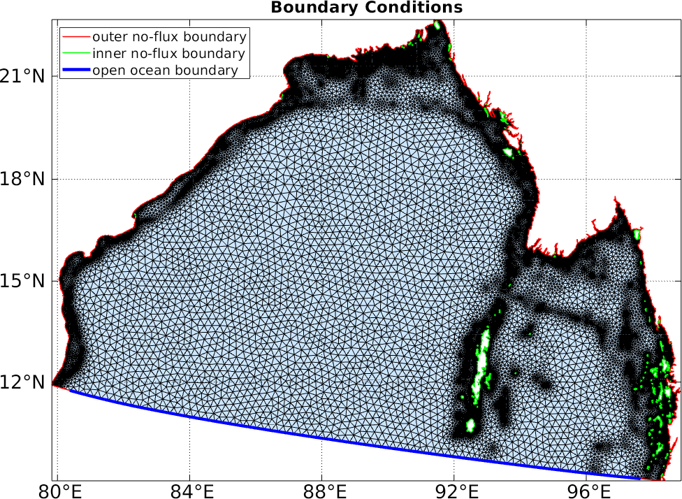
- We used the physics-based hydrodynamic model ADCIRC-2DDI (ADvanced CIRCulation model, two-dimensional barotropic tides, Version 55.01) in our study.
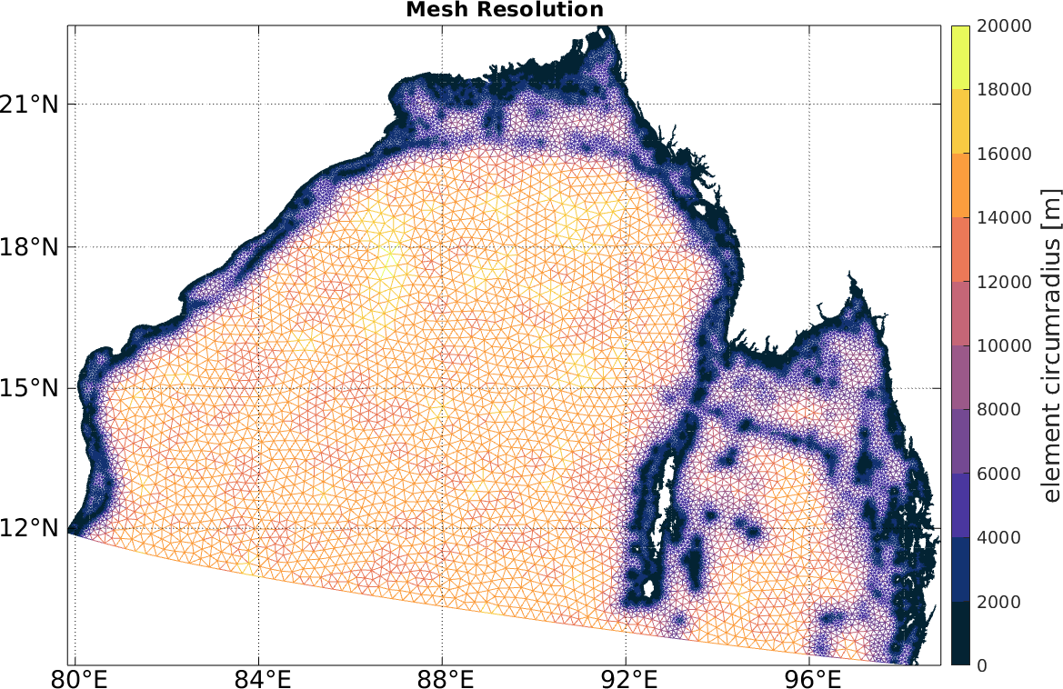
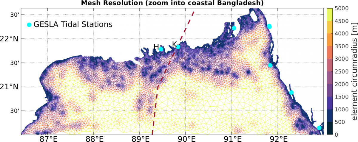
- A high-fidelity unstructured mesh was designed using OceanMesh2D (flexible, reproducible and scriptable) to accurately represent the complex coastal features, with a total of 62,009 vertices and 115,199 elements.
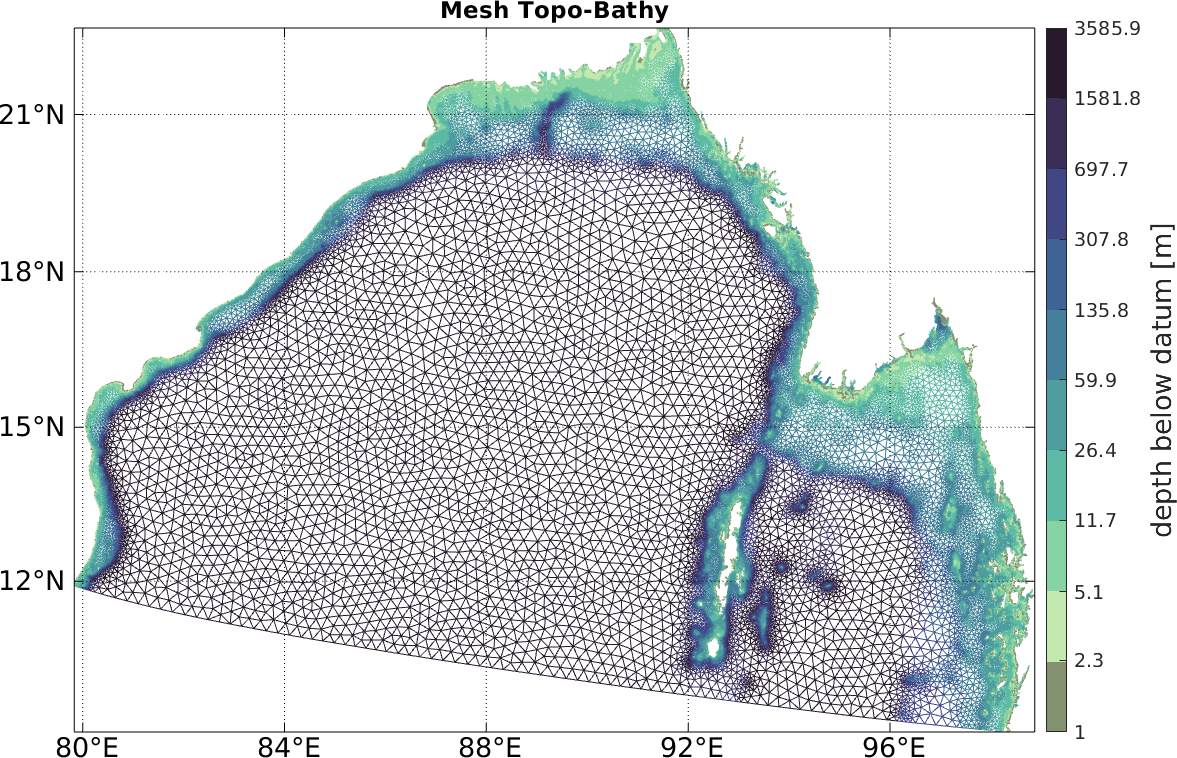
- The bathymetry data used the General Bathymetric Chart of the Oceans (GEBCO) at 15 arc seconds globally for the main Bay of Bengal and an updated dataset from (Krien, et al., 2016) for the nearshore area, ensuring accurate representation of the seafloor topography in the simulation.
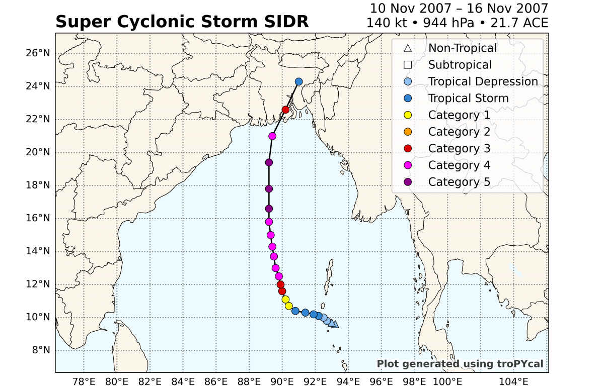
- Historical tropical cyclone Sidr ("IO062007") was chosen to validate the performance of our hydrodynamic model.
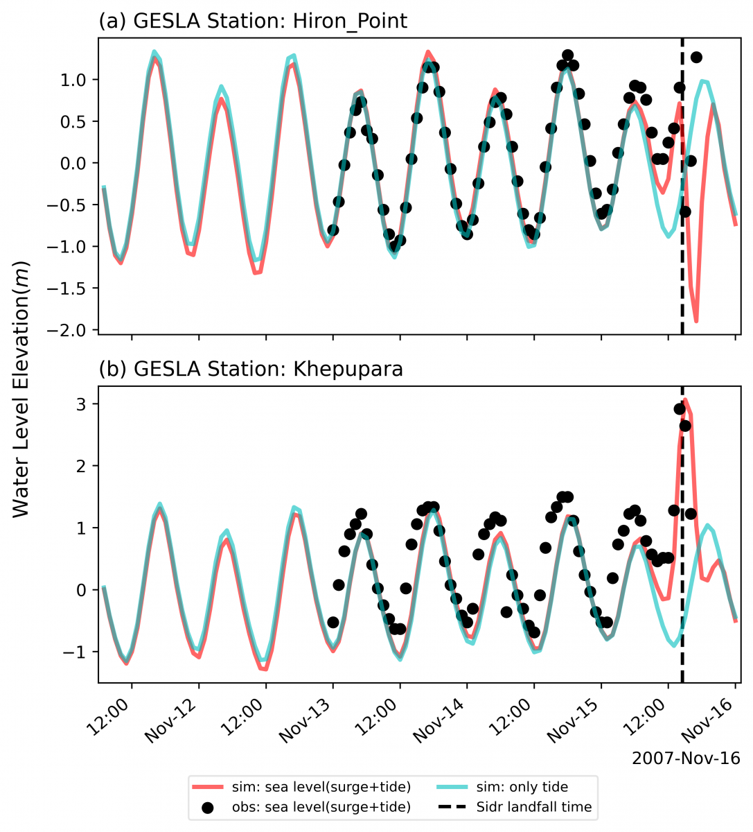
- Water level time series at Station Hiron_Point (Lon: 89.467, Lat: 21.783) and Khepupara (Lon: 89.833, Lat: 21.833) were used for model validation, with observed data obtained from GESLA (Global Extreme Sea Level Analysis, Version 3.0) and (Khan et al., 2022).
- Through this comprehensive validation process, we aimed to assess the performance of our hydrodynamic model and ensure its suitability for capturing storm surge dynamics and water level variations in the study area.
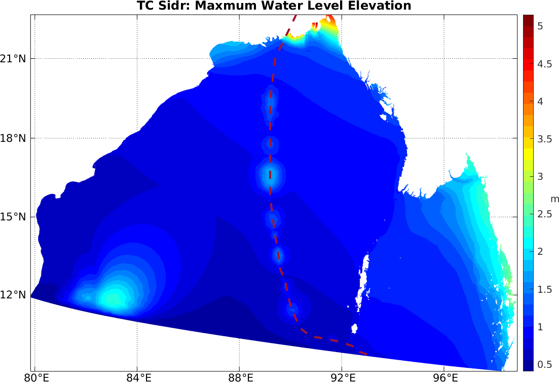
More details about our model development and validation process can be found in the following table and figures:
| Edgelength function | Parameter |
|---|---|
| min reso | 1 km |
| max reso | 20 km |
| wave length | 30 |
| slope | 10 |
| filter | -50 |
| grade | 0.35 |
| feature width | 3 |

(details forthcoming).
ESSG Team: Jiangchao Qiu, Anamitra Saha, Joaquin Salas, Sai Ravela, Kerry Emanuel